Travel
Travel Guide: Biking From the Border to Boston – Streetsblog Massachusetts

The Border to Boston trail is a proposed 70-mile route that will eventually connect Seabrook, New Hampshire to downtown Boston via Newburyport, Salem, and Lynn along abandoned railroad rights-of-way.
Like many long-distance rail trails in Massachusetts, the Border to Boston trail is an ambitious vision – so much so that five years ago, when I started writing for StreetsblogMASS and learned about the project, I was skeptical whether it would ever become a reality.
But every year, the cities and towns along those long-distance trails are finishing more projects that make the gaps smaller and bring the vision closer to reality.
If you choose a slightly different starting point – starting from Haverhill instead of Newburyport – it’s already possible to ride from the state line to downtown Boston on a route that uses off-street trails for three-fifths of the route.
Last week, on one of the first days when the summer’s heat gave way to cooler, drier, more autumnal weather, my friend Peter and I set out to ride from Haverhill to the StreetsblogMASS newsroom in downtown Boston, using as many trails as we could along the way.
Haverhill to Georgetown
We started our trip with a pre-dawn Amtrak Downeaster train to downtown Haverhill, about three miles away from the New Hampshire state line.

After grabbing a coffee and a pastry from the Wicked Big Cafe, we crossed the Merrimack River on the Basilere Bridge, whose poorly-paved surface and reckless drivers unfortunately ranked it as one of the less bike-friendly segments of the trip.
Luckily, once we were on the opposite shore, we were able to hop off the roadway and onto our first rail-trail of the day, the Mayor James J. Fiorentini Bradford Rail Trail.
The Bradford Trail generally follows the southern bank of the Merrimack River along an abandoned rail right-of-way that extends about three miles into the neighboring suburb of Groveland, and the city and MassDOT are working on plans to upgrade that right-of-way into an accessible trail.
But for now, most of that route is still inaccessible, so after a quarter-mile, we joined the morning rush hour traffic on the parallel Salem Street through Haverhill’s suburban fringes until we got to Main Street in Groveland.
There, we were able to try one of the Commonwealth’s newest rail trails, the Groveland Community Trail, which opened last spring.

The Groveland Trail is about two miles long and ends at King Street on the Groveland-Georgetown town line. While the right-of-way continues further east as a power line corridor, there are currently no plans in the works to make it a passable trail. Luckily, the on-road alternative, around Rock Pond and into Georgetown’s village center, is a quiet, low-stress route.
In Georgetown, the trail rejoins the power line corridor, but this segment of the trail gets very little maintenance: its surface is in relatively good condition, but it’s also very overgrown. The entrance from Andover Road is therefore easy to miss (here and elsewhere along the Border to Boston route, you can find it by looking for the twin pair of power lines overhead).

Georgetown to Peabody
One thing we noticed on the ride is how trail conditions vary across town lines – a symptom of how these regional trails generally get built on a town-by-town basis. After a mile of riding through dense undergrowth in Georgetown, we crossed into Boxford, where someone had kindly mowed the trail corridor so that we no longer had to bushwhack through waist-high grasses.
After another easy on-road detour to get across Interstate 95, we re-joined the trail in Topsfield, where the trail got wider and gained a smooth, stone-dust surface:
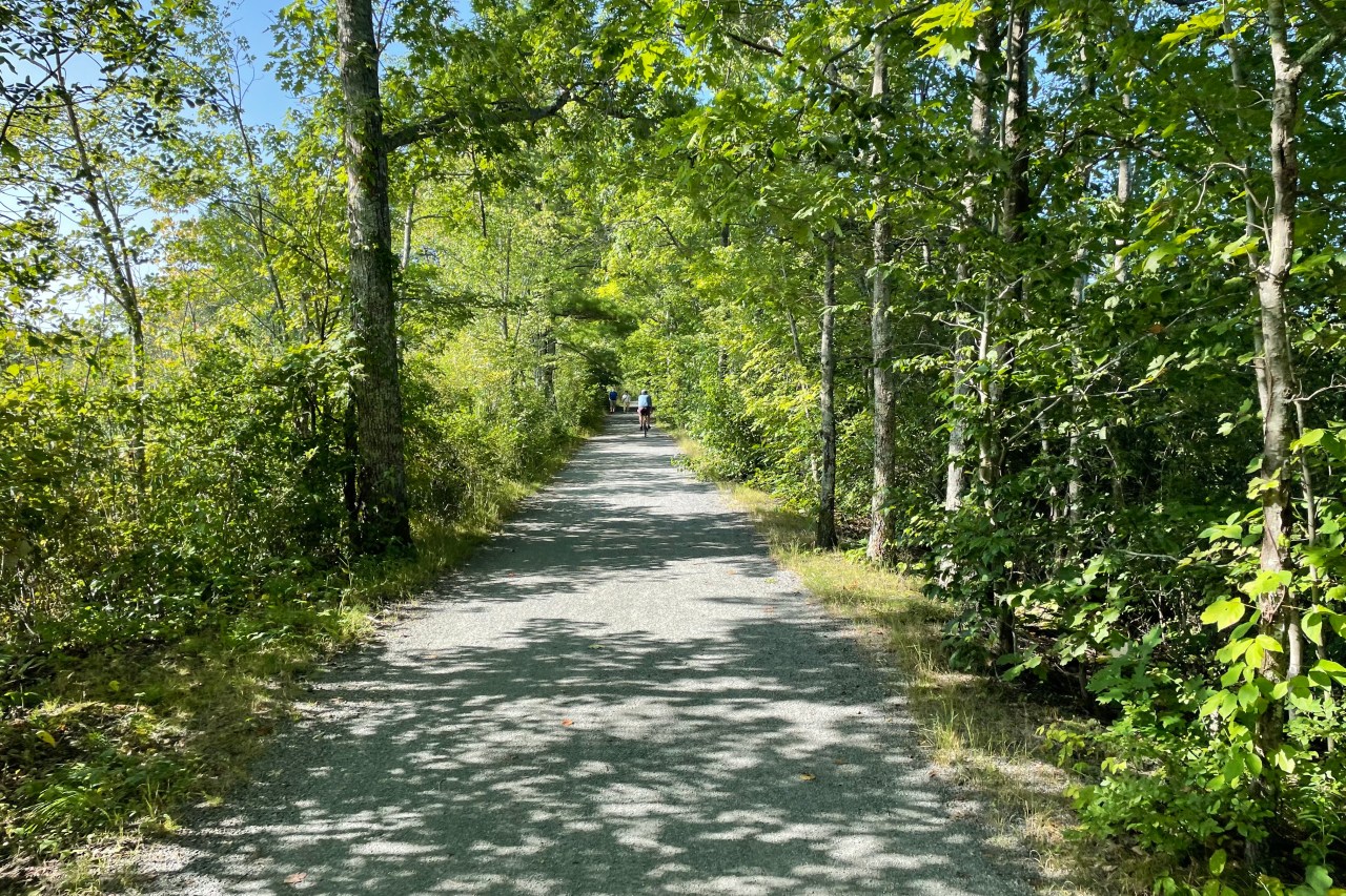
The segment between Topsfield and Peabody is one of the longest uninterrupted segments of the the Border to Boston trail – it’s about 10 miles long.
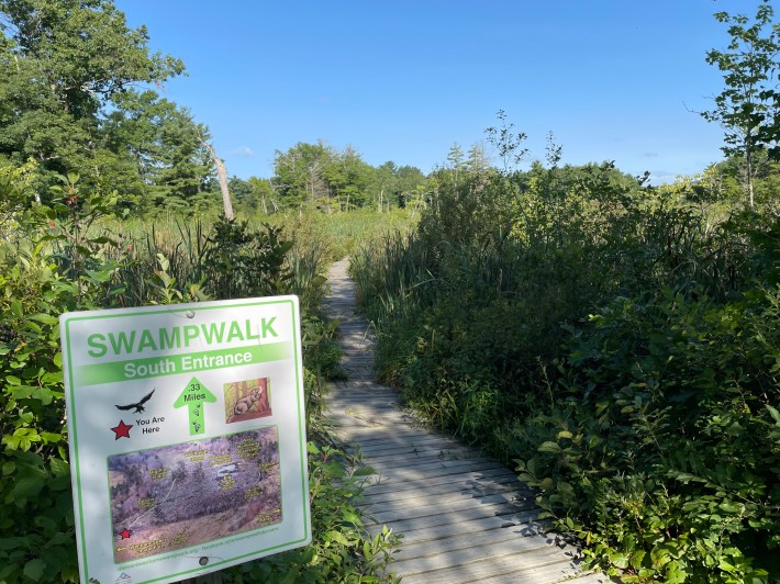
It’s also one of the most scenic parts of the Border to Boston route. Southeast of Topsfield’s quaint village center, the trail runs on an embankment along the Ipswich River and through the Wenham Great Swamp.
But all good things must end, and this particular part of the Border to Boston trail peters out among some forsaken strip malls wedged between I-95 and Route 1 in Peabody.
Peabody to Salem
Luckily, a short ride through a cemetery brought us to our next trail, the Peabody Independence Greenway.
Peabody is a fairly car-dependent suburb where several expressways – Interstate 95, Route 128, and Route 1 – make walking and biking a risky enterprise.
The existing Independence Greenway has two disconnected segments on either side of I-95, and the Greenway still doesn’t connect to the city’s downtown district. As a result, the on-road Border to Boston route through Peabody traverses some pretty awful roadways, including the shoulder of a Route 128 off-ramp and the potholed, four-lane Andover Street.
As we crossed the city line into Salem, we were able to reduce our cortisol levels on several new-looking off-street bike paths along the banks of the North River, which took us to the MBTA commuter rail station downtown.
At this point, we’d covered about 30 miles and I needed a break, so we stopped for a snack and our second caffeinated beverage of the day at Odd Meter Coffee on Washington Street.
Salem to Boston
The most direct route from Salem to Boston would follow State Highway 107, which offers a straight connection into Western Avenue in Lynn.
But much of Route 107 in Salem is a four-lane expressway, so we opted to continue along the official Border to Boston trail route, which follows a more meandering route along the shoreline in Marblehead and Swampscott.
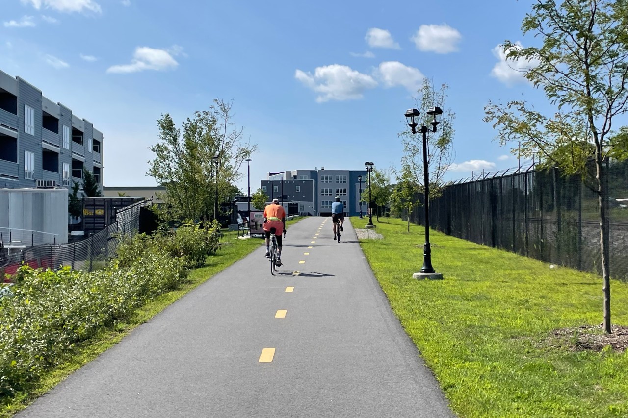
From downtown Salem, we hopped onto the Mayor Antony Salvo Bike Path (pictured above), which follows the Newburyport MBTA line through the south end of Salem. At the town line with Marblehead, we got our first view of the ocean (below).
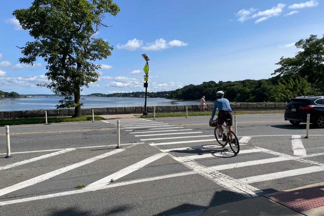
After a short ride on local streets through downtown Swampscott, we hopped onto the oceanfront promenade of Lynn Shore Drive and got our first glimpse of the Boston skyline as we approached Nahant Beach.
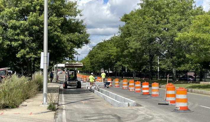
Our destination was in sight, but first, we had to get across the Lynnway, the awful six-lane highway that divides Lynn’s working-class downtown neighborhoods from the sandy beaches that line Nahant Bay. The Lynnway’s asphalt mess is owned and maintained by the state’s Department of Conservation and Recreation, which allegedly “protects, promotes, and enhances the state’s natural, cultural, and recreational resources.”
Riding along the Lynnway was another lowlight of the trip. But as we rode on the highway’s bumpy sidewalks, we came upon a construction site where workers were placing new granite curbs into the roadway – part of the city’s Northern Strand Trail extension project. In a few more months, this segment of the Border to Boston route will be considerably easier to ride.
Once we got across downtown Lynn, we hopped on the Northern Strand Trail, which runs another 10 miles to the Boston-Everett city line on Alford Street, next to the Encore Casino (we wrote another travel guide to the Northern Strand when it opened in 2021 – read it here).
After one final stressful segment across the Alford Street bridge and Sullivan Square, we hopped on the Somerville Community Path and continued into downtown Boston to feast on a late lunch of hand-pulled noodles in Chinatown.
These were the worst parts, and how they’ll get better soon
All told, our trip from Haverhill to downtown Boston spanned 57 miles, which we did in a little over six hours.
Of that distance, a little over 34 miles of the trip – 60 percent of the mileage – was on dedicated off-road pathways. The longest uninterrupted off-road sections were the Northern Strand (10 miles between Boston and Lynn), the Topsfield Linear Common and Danvers Rail Trail (9.5 miles between Peabody and Topsfield), and the Marblehead Rail Trail (5.1 miles between downtown Salem and Swampscott).
In between those trails, though, there are still some fairly intimidating on-road segments. We found that the worst sections of our trip were in the suburbs of Haverhill and Boston, where traffic is heavier.
Luckily, MassDOT and the cities and towns along the route are working on plans to improve safety on those those sections or bypass them with additional new trail projects in the years to come.
In Peabody, for instance, the city and MassDOT are working on several projects that will extend the Independence Greenway and bridge the various expressways that divide the city. Within the next decade, the city should have an uninterrupted off-street greenway from West Peabody to downtown Salem.
In downtown Lynn, the under-construction Northern Strand Extension project should eliminate another major stressful connection by early next year. With its connection to the existing oceanfront esplanade along Lynn Shore Drive, bikes and pedestrians will get a continuous 13-mile off-street trail that extends from the Mystic River in Everett to downtown Swampscott.
And at the end of the route in Boston, several projects are in the works to improve bike and pedestrian connections into downtown: a major road diet for Rutherford Avenue, which could install new bike paths between the Charles River and Sullivan Square; a newly-funded busway that could add protected bike facilities on the Alford Street bridge; and (someday) a dedicated bike and pedestrian crossing of the Mystic River to connect the Northern Strand to Assembly Square in Somerville.
We’re looking forward to doing this ride again in a few years after more of those projects cross the finish line. In the meantime, you can follow updates on their progress here on StreetsblogMASS.
To learn more about the Border to Boston trail, visit its official website.
You can also view a map and download turn-by-turn cue sheets for the on-road segments of the Border to Boston route from the East Coast Greenway (note that their map does not include the singletrack trail segments in Georgetown and Boxford, although those trails are passable for most bikes).

I Don’t Believe In Fashion Faux Pas—But This Winter Style Mistake Always Makes Me Cringe

Building skills, knowledge and community with Fresno State’s Hispanic Business Student Association

World Chess Championship 2024: Ding Liren v Gukesh Dommaraju pre-match questions, answered

‘Fitness freak’ Cynthia Erivo wore her fitness watch underneath her Wicked costume

No. 10 North Carolina proves too much for Hawaii men’s basketball team

Minimum wage roulette: Californians wisely reject measure costing jobs for dubious gains

Your Free Daily Horoscope for November 23

Liverpool To Face Real Madrid with Major Injury Concerns

Italy’s working visas are notoriously hard to get. We spoke to Americans who managed it | CNN
