Travel
Cold blast to bring lake effect snow to multiple states as post-Thanksgiving travel underway

The first big snowstorm of the season is threatening to bury New York towns along lakes Erie and Ontario during a hectic holiday travel and shopping weekend.
An Arctic outbreak of cold air will expand south and east and bring “dangerously cold wind chills” into the Northern Plains and Upper Midwest, the National Weather Service said Saturday, while heavy lake-effect snow could make travel “very difficult to impossible” into next week.
“Travel will be extremely difficult and hazardous this weekend, especially in areas where multiple feet of snow may accumulate very quickly,” the National Weather Service said Saturday.
CBS New York meteorologist John Elliott said “very intense snow” will hit communities along the Great Lakes, Plans and Midwest regions.
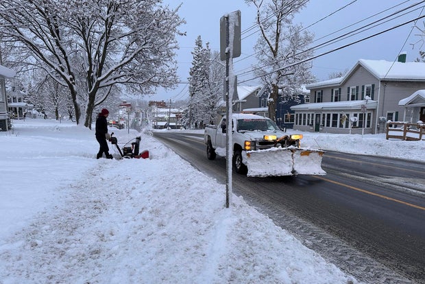
Cara Anna / AP
Cold weather advisories were issued for parts of North Dakota on Saturday and high pressure from central Canada will move south into the Northern Plains by Monday. A freeze warning will be issued over the Central Gulf Coast states to the Southeast, the weather service said.
Part of Interstate 90 in Pennsylvania was closed Saturday, as were westbound lanes of the New York Thruway heading toward Pennsylvania. Nearly two feet of snow have already fallen in parts of New York, Ohio and Michigan and some 29 inches of snow was recorded in Pennsylvania’s northwestern tip.
The roads in parts of northwestern Pennsylvania became so impassable early Saturday that scores of people took refuge overnight in the lobby and hallways of a fully booked Holiday Inn hotel near I-90. Jeremiah Weatherley, a staffer at the hotel, said dozens of people rolled in as the snow piled up, with workers opening the hotel’s conference room and giving people blankets so they could sleep on the floors.
“It was hard to manage but we had no choice,” he said. “They just showed up and we don’t want to turn people away.”
Light to moderate snow was expected from the middle Mississippi Valley to the central Appalachians on Saturday, with similar snow conditions over parts of the Northern Plains and upper Mississippi Valley and central Appalachians on Sunday, the weather service said.
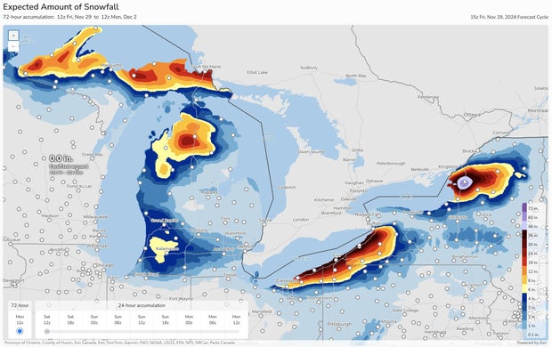
In Michigan, heavy lake-effect snow in northern parts of the state was expected to continue into the weekend, according to the National Weather Service in Gaylord. Some areas of the Upper Peninsula could see up to 3 feet of snow Sunday night through to Monday, National Weather Service meteorologist Lily Chapman said.
New York state forecasters warned that 4 to 6 feet of blowing and drifting snow could fall in Watertown and other areas east of Lake Ontario through Monday.
National Weather Service
After an unusually mild fall, as much as 2 to 3 feet of snow were possible along Lake Erie and south of Buffalo from lake-effect bands notorious for pummeling the region with snowfall rates of 2 to 4 inches per hour. Lake-effect snow happens when warm moist air rising from a body of water mixes with cold dry air overhead.
“The lake is 50 degrees We’re about six degrees above where we should be this time of year, that’s why we’re seeing these heavy lake-effect events,” Erie County Public Works Commissioner William Geary said. “The outlook for the next two weeks into December, we’ll probably see some more.”
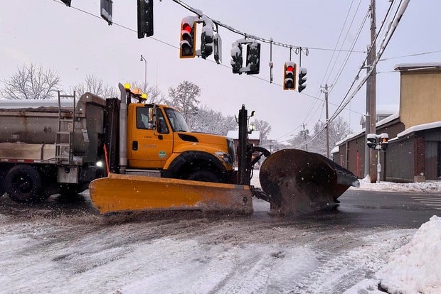
Cara Anna / AP
New York Gov. Kathy Hochul declared a disaster emergency for the targeted counties, allowing state agencies to mobilize resources. Rapidly deteriorating conditions Friday caused closures along Interstate 90, and tandem and commercial vehicles were banned from Interstate 86 in western New York and much of U.S. Route 219 beginning Friday afternoon.
“There’s a considerable number of vehicles going off the road on the 219 currently,” Gregory Butcher, Erie County deputy director for preparedness and homeland security, said at an afternoon briefing.
ATVs and snowmobiles were being placed around the county to help first responders if necessary, Butcher said.
The Buffalo Bills called for volunteers to potentially shovel snow at Highmark Stadium, where over 2 feet of snow was possible before Sunday night’s game against the San Francisco 49ers.
“It’s going to be slow going, there’s no doubt about that,” Erie County Executive Mark Poloncarz said, adding the heaviest snow is expected to be over by kickoff.
Lake-effect snow also covered parts of Michigan’s Upper Peninsula in a system that is expected to last through the weekend. The area was blanketed in snow by Friday afternoon, with some places already measuring more than a foot of snow.
“We’ve got this westerly, northwesterly flow regime and this chilly air mass over the U.P.,” said Chapman of the National Weather Service. “So it’s a pretty good setup for this long duration lake-effect snowfall event.”
Gusty winds, especially near the Great Lakes, have impacted visibility in Michigan and Chapman urged caution on the roads.
Joe DeLizio, a meteorologist for the National Weather Service in Gaylord, said visibility on roads was low but he hadn’t been made aware of any major accidents so far.
“Haven’t heard too much as far as problems, but obviously travel is pretty difficult,” DeLizio said.


